Kids Page - new position report updates, July 2, 2003
As the flight progresses I'll spend time talking about the states or countries that I'm flying over and I'll ask aviation and geography questions to make it interesting and a little challenging.
You will be able to see my last position report on www.aprs.net/cgi-bin/winlink.cgi?KE4HBO. To see a complete track of my position reports, go to http://mmsn.techmonkeys.net/ and enter my call sign, KE4HBO. Currently there are only 5 position reports.
August - Iceland and Greenland
Greenland is the largest island in the world and the second largest ice cap, after Antactica. The majority of it's landmass is covered in ice up to 3000 meters thick, above sea level. The area that is not under ice is about the size of the British Isles. The population is less than 60,000 people. The native Greenlanders are of Inuit or eskimo descent. The country was a colony and is now a part of Denmark. The languages spoken are Greenlandic and Danish. The legend is that Eric the Red gave the name to Greenland to pursuade people of Iceland and Norway to settle there. In reality Iceland is more green and Greenland has more ice.
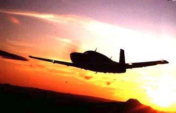
Some fun facts on Greenlandair: 460 employees, 200,000 passengers; planes: 1 B757, 4 DASH-7s, 2 Twin Otters, 1 Beechcraft Super King Air 200, 1 Piper Super Cub and 1 Cessna 172; helicopters: 4 S-61s, 4 Bell 212s, 6 Aerospatiales AS350, 4 Huggies MD500 and 1 Bell 407. Because Greenland has no roads connecting it's cities, Greenlandair is the umbilical chord between the many sparsely populated areas of this vast country. Construction in underway for 7 new airports along the western coast of Greenland as fixed wing planes replace ageing helicopters.
Iceland is a small, independent country 560 miles northwest of the British Isles. It is mainly volcanic and has numerous natural hot springs and pools. There is four main ice caps; the largest, with numerous glaciers, is on the southeast side of Iceland, near Hofn. Iceland's flying history began in 1919 with an Avro biplane, just 16 years after the Wright brother's historical flight. In 1928, passenger flight began to Iceland.
July - Crete (Greece), Sardinia (Italy), Switzerland, France, England, Ireland, Scotland
Crete is a large island in the middle of the Mediteranean and is part of the country of Greece. It has mountains up to 11,000 feet along a central spine that descend to the sea all around. It has a relatively dry climate and lots of tourists. What is the capital of Greece? Where is it located?
Sardinia is an island off the west coast of Italy and is part of Italy. It also has mountains and a lot of sun. Just north of Sardinia is another island, Corsica, but it is part of France. There is an independent country with the country of Italy, do you know what it is?
France is part of continental Europe, between Spain to the southwest, Italy to the southeast and Belgium and the Netherlands to the northeast. It is well-known for it's wine and cheese but also has beautiful countryside and abundant agriculture. What is the capital of France? They use to have the French Franc as their money but now most of the countries in Europe use the Euro as their currency.
England is a very small but densely populated island country north of France. It is separated from mainland Europe by the English Channel. It is lush and green, due to the large annual rain fall. It is known to be cloudy and foggy, but during the summer, there are warm sunny days. Becasue it is relatively far north in latitude, during the summer the days are long with sunset close to 10pm and sunrise about 5am. Unfortunately, the winter days are very short, sunrise around 8am and sunset 4pm. Other countries included in the United Kingdom or Great Britain include Wales to the west of England, Scotland to the north and Northern Ireland, to the north of the island of Ireland to the west of England. What is the capital of England? What type of government do they have?
June - South Africa, Namibia, Botswana, Zambia, Ethiopia, Djibouti, Egypt
Africa is a large continent with a lot of countries. I started at the southern end of the continent in South Africa. Pretoria is the capital and it's close to Johannesburg in the northern part of the country. The country has a variety of climates because it is at sea level on the coast and 4000 feet to 6000 feet inland, with mountainous areas going higher. The people were very friendly and open to helping strangers (like me).
Cape Town, in the south west, is picturesque with the bay and mountains all around. It's very fertile and is the wine growing region of South Africa.
Namibia use to be part of South Africa and is now an independent country to the north of South Africa. It's very dry and much of the land is a desert. To the east of Namibia is Botswana which is arid to the west, but has an amazing delta which floods each year when water comes down the river after the rainy season further north. The animals come to the delta for food and water and many herds can be seen while driving around. We saw lion, water buffalo, giraffe, elephant, impala, elan, one leopard, and many other animals.
North of Botswana are Zambia and Zimbabwe. These countries share the Victoria Falls as their border. These falls are over 2 kilometers long and were formed by a fault. Following the east coast of Africa up to the north, after Zambia, I crossed Tanzania, Kenya and stopped in Ethiopia.
To the east of Ethiopia are Djibouti and Eritrea, which was once part of Ethiopia but is now independent. To the north is Sudan, then Egypt. I hope you can find all these countries on your map. Sudan and Egypt are dry deserts except where the rivers, like the Nile, flow through. There they become lush green with crops.
May 27, 2003 - Maldives, Seychelles, Madagascar
I just left the Seychelles today after a wonderful week there. Have you found the Seychelles on your map or globe? They are a small group of islands, but cover a large area of water just north and east of Madagascar off the east coast of Africa. The is much indigenous plant life as the islands are made of granite, not volcanic, and have been above the ocean for over 750,000 years. I saw Coco de Mer palms that have the largest seeds in the world and only grow in the Seychelles. It takes 25 years from planting a seed to producing another seed. The Seychelles is very proud of it's beauty and retains about 46% of the landmass as national reserves.
There were no people inhabiting these islands before they were discovered around 1750s by the Portuguese, then colonized by the French, then the English. They established their independence in 1977.
If you followed my position reports, did you find the Maldives? They are beautiful also, but in a different way, they are more like the Bahamas. They are flat and sandy. I also flew over Madagascar when I left the Seychelles on my way to South Africa. Madagascar is a much bigger island than either the Seychelles or Maldives. It has a huge mountain ridge running down the center, over 11,000 feet high. Do you know the capital of Madagascar? It's a little difficult to pronounce.
May 17, 2003 - Indonesia, Singapore, Malaysia, India
I've visited a number of countries over the past few weeks; I hope you've been following the position reports that I've been sending in. I'm sure you found Darwin, Australia on a map. I left Darwin in early May and flew over a country made up of many islands called Indonesia. You may have heard of Indonesia last year when there was a bombing in a night club in Bali in October 2002. Bali is a very small tourist island on the southern chain of the islands that make up Indonesia. I flew over the island country of Timor, further to the east of Bali. Have you found the capital of Indonesia on the map? What is it called? There are oil supplies in Indonesia, so many oil companies from the US and Europe have engineers and their families living there. It's a tropical climate, hot and humid most of the time. But with small islands in the sea, there is usually a sea breeze.
North of Indonesia is the Asian continent. There is a VERY small country on the southern tip of Malaysia called Singapore. Singapore is well known as a free trade area or an area where there is a tremendous amount of trade through the ports. The sea was crowded with ships as I few over. I landed in Singapore, but actually had to fly over Malaysia on my approach as they are so close to each other, only separated by a small channel. To the north of Singapore is a long country stretching north and south called Malaysia. I flew to Malaysia to fill up with gas. The capital of Malaysia is further north and I flew over that on my way to India. Is the capital shown on your map.
There is a large body of water between India and Malaysia called the Bay of Bengal. To the west side of India, the body of water is called the Indian Ocean. I'll be flying over that on my way to the Seychelles next week. The capital of India is to the north of the country. While in India I toured Chennai (previously called Madras), Delhi, Agra (where you see the Taj Mahal), Jaipur, Shimla in the Himalayian Mountains, and Trivandrum on the south west coast. Are all the cities shown on your map? India is very hot and dry. All the rivers that I drove or flew over were dry river beds. The monsoon season is about to begin next month. Then it will rain for 2 or 3 months and fill the rivers and help the vegitation and crops. India has a very high population of over one billion people. Don't forget, Australia only had 20 million people. So, while I was in India, everything was crowded, the streets, the villiages, and the trains.
Can you find the Seychelles? They are a small group of islands to the northeast of Madagascar, off the east coast of Africa. I'll be there next week and will tell you what they are like.
Still in Australia, late April:
I've filed a number of position reports everywhere I've stopped in Australia. Can you plot them on a map and see where I've been? The population is relatively dense, i.e. there are a fair number of people, on the east coast of Australia. That's where most of the major cities are located. There is Melbourne to the south, Canberra a little further north. Sydney then Brisbane closer to the middle on the east coast then some smaller towns, Maroocheedore and Rockhampton before reaching Cairns (pronounced Cannes) to the north. The whole population of Australia is less than 20 million people -- how does that compare with the US? Of the 20 million over half live in the major cities named above plus two other cities, Adalaide and Perth. The other 10 million are scattered, sparsely, over the remainder of the continent. That makes for a lot of land and very few people.
I just visited the Stockman's Hall of Fame in Longreach, Queensland, Australia. It's a tribute to the pioneers who crossed the land in wagons and with horses and camels to discover the interior and to map the country. They were very much like the cowboys and covered wagons of the US frontier and lived a very similar lifestyle with the hardships of life back then.
I also visited the QANTAS museum; it's a tribute to the men who founded Australia's national airline QANTAS back in 1921. It is a fascinating story of two World War I pilots who returned home to Australia and decided there must be a better way to travel across their country rather than by car which was slow and not always reliable.
Ayers Rock was an Aboriginal religious meeting place. It is now a national park and monument close to the middle of Australia. It's really a site to see, a huge sandstone sticking up 348 meters (1,141 feet) with nothing but flat land all around it. It's 9.8 kilometers (5.8 miles) in circumference and is believed to extend 6 kilometers (3.2 miles) beneath the ground.
In Australia, early April, 2003:
Tasmania is the small island state to the south of Australia. It is actually made up of other islands as well. One is King Island to it's northwest and the other is Flinders Island to the north east. Normally these islands get a lot of rainfall and are lush and green. King Island is renown for it's cheese and butter due to the lush cattle feed. King Island only has a population of 1800 people.
Being the furthest point south in Australia, Tasmania is colder than the rest of the country. It's major city is Hobart which is close to the southern tip. I flew over many beaches which were beautiful and empty.
I am now flying further north along the east coast. Brisbane is north of Sydney and Cairns (pronounced Cannes) is even further north.
I went to Dubbo for a few days. It's west of Sydney over a range of mountains. It's the start of the farming areas and outback and is very dry with huge expanses of open area. Do you have a map of Australia? Can you find all these cities?
Fifth Leg, March 31 - April 1, 2003:
There are two islands between New Zealand and Australia, can you find them on a map or globe? What are there names? Do they belong to New Zealand or Australia?
What is the population of Australia? What is the capital of Australia.
From my position reports, you should be able to calculate the distances between the islands? How far apart are they? How far from Lord Howe Island to Sydney?
What were the islands used for in the 1800s? They have a fascinating history.
What is their major "industry" today?
Fourth Leg, 14March, 2003:
You can just barely see New Zealand on the map above. It might be better to get a globe or big wall chart to see this island nation better. How many islands make up New Zealand? Actually, I don't know how many all together, there are islands everywhere. But, there are 2 main islands that are referred to as the North Island and the South Island. I spent most of my time on the North Island. What is the capital of New Zealand?
What is the population of New Zealand? There are about 60 million sheep and 16 million visitors annually. The population is less than both of these figures.
What is the native tribe called?
There are volcanos everywhere in New Zealand; much like Hawaii. One, off the east coast is smoking..... but an eruption is not expected.
I will be sending in position reports for the airports where I landed in New Zealand. See if you can locate them on a big map. One is on the South Island.
What is the VERY big island off to the west of New Zealand? I'll be visiting there next.
Third Leg questions, 11Mar03:
What time did I cross the equator? What's the distance around the world at the equator?
Are there any islands between Hawaii and American Samoa? Could I have stopped at one?
Is American Samoa in the north or south hemisphere?
What was my average speed between my reporting points during this leg?
What islands are to the south of American Samoa?
What major line of longitude will I cross on my next leg? What does that mean in terms of what day it is?
Which direction does the wind turn around a cyclone in the southern hemisphere?
Second Leg questions, 5Mar03:
How many position reports did I file? Where were they?
What is the distance between the two position reports over the Pacific (need to know how many miles between degrees of longitude and latitude)
What is the biggest island in the Hawaiian chain? (hint, the one I'm on)
How many islands are there in the Hawaiian chain? (inhabited islands only)
How were the Hawaiian islands formed? (hint, the National Park that I went to visit)
If Hilo Airport has a blue dashed circle around it, what type of airspace is it?
Did I need oxygen when I flew to visit the Mauna Kea crater on Hawaii at 13,796 ft?
First Leg questions, 28Feb03:
Over which states did I file position reports?
Over which city would my altitude have been the highest? Why?
If I'm now in Southern California, what major airport am I close to? What type of airspace surrounds this city's airport? What color is it on the VFR sectional?
If it's 603 nautical miles from Mobile Alabama to Abeline, Texas and 243 nautical miles from Abeline to Roswell, New Mexico and I crossed Mobile at 1:15pm, Abeline at 5:30pm and Roswell at 7:45pm, what were my average speeds on these two legs?
It took me 6 hours and 15 minutes from Roswell to Bracket Field in California and it's 665 nautical miles. What was my average speed? What happened to slow me down after Abeline?